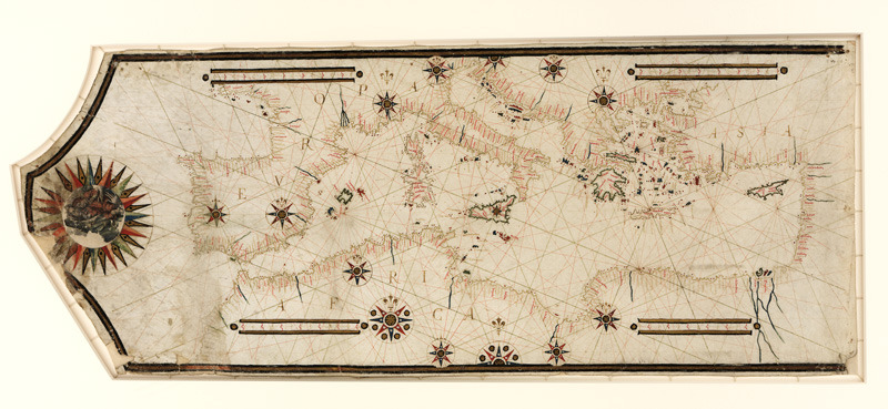
This 16th-century portolan chart of the Mediterranean is vastly more accurate than any Ptolemaic map.
A 16th-century portolan chart of the Mediterranean
Related Posts
This 16th-century portolan chart of the Mediterranean is vastly more accurate than any Ptolemaic map.